








Explore Cases Government Emergency Response
Rail HazMat Release: The Plume the Model Missed
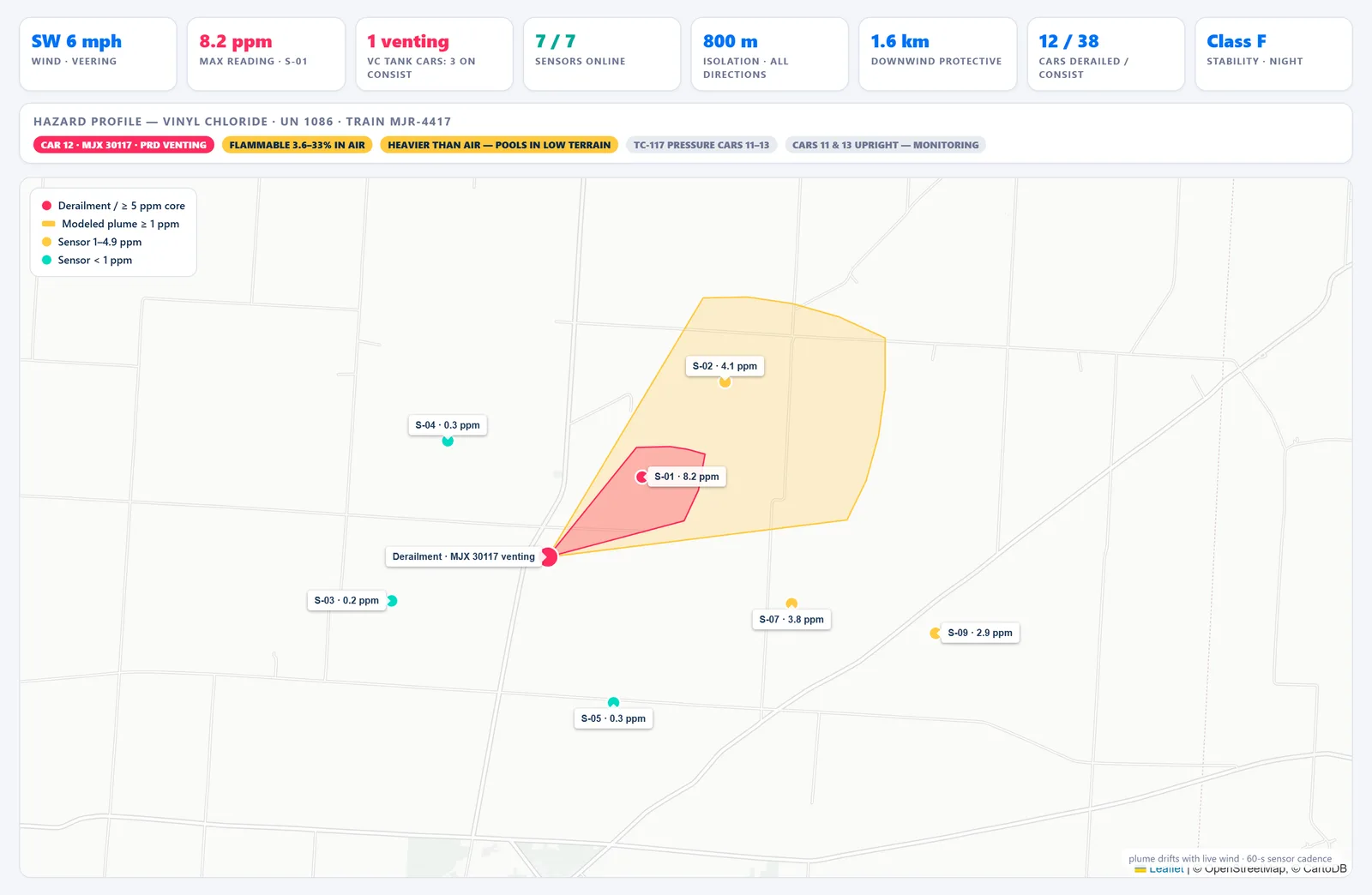
The first plume model says the neighborhood is clear. Then field sensors begin showing readings where the model predicted none. As wind, terrain and atmospheric conditions shift, responders need to understand what changed—and which schools, care facilities, routes and resources now sit inside the real hazard area.
Capabilities
Overview
Hazardous-material response depends on models built from assumptions about wind, stability, terrain and the release itself. Those models are essential, but they can diverge from field conditions. At the same time, manifests, chemical references, sensor readings, facility locations and evacuation resources may be maintained in separate systems.
CoAnalyst360 keeps the modeled picture and incoming observations in one workspace. Manifest and chemical data can inform the initial model, while sensor readings and terrain context help identify meaningful divergence. As conditions change, affected facilities, populations and available response resources can be re-evaluated so incident commanders have current evidence for evacuation and resource decisions.
Key features
- Consist and cargo resolution Pull the rail consist or vehicle manifest, identify hazardous cargo and container types, and attach chemical properties and emergency-response guidance without a manual lookup.
- Dispersion modeling Model the release against current wind, stability class and release conditions, and re-run whenever the driving inputs move.
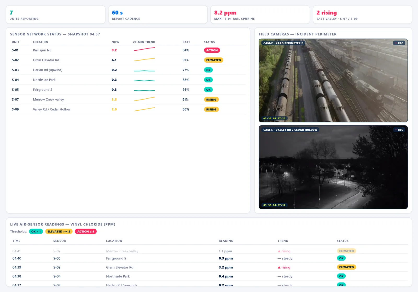
- Live sensor reconciliation Ingest field air-monitoring telemetry at cadence and compare measured readings against the modeled envelope, so a model that is wrong is caught by the data rather than by the outcome.
- Terrain and inversion analysis Test the modeled plume against terrain cross-sections and boundary-layer conditions to catch the valley channeling and nocturnal inversions a flat dispersion model misses.
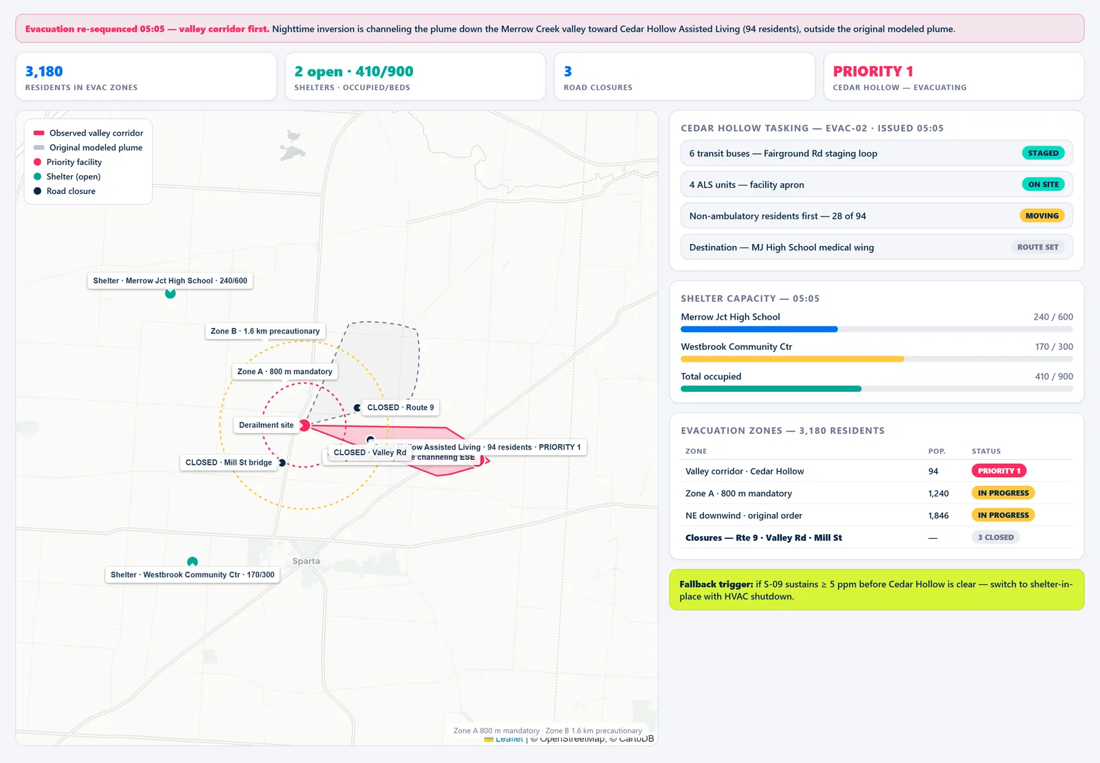
- Critical-facility sweep Sweep schools, care homes and medical facilities across the affected radius — including those missing from the primary registry — and rank them by exposure and evacuation difficulty.
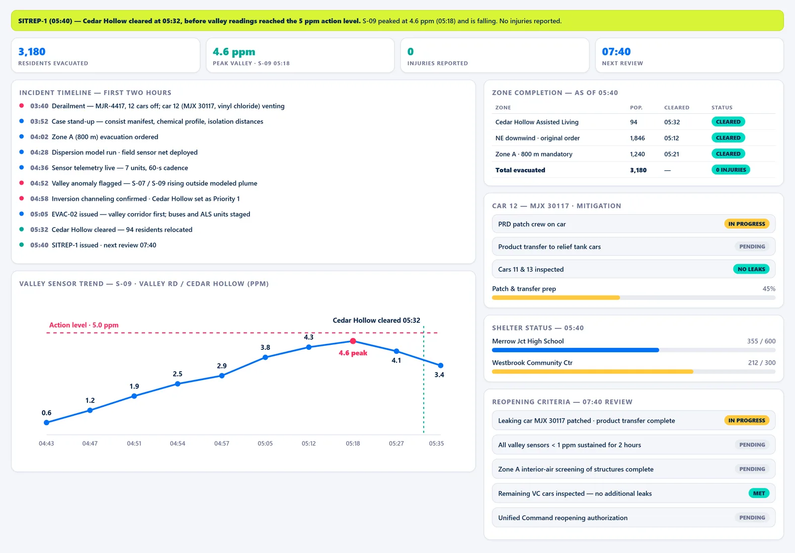
- Evacuation sequencing and resourcing Draft zoned evacuation sequencing for incident command, match transport, EMS and shelter capacity against the population warned, and track clearance corridor by corridor.
See CoAnalyst360 on your own data
Bring your existing data sources into a coordinated investigative workflow. See how CoAnalyst360 can help your team move from a question to evidence-backed findings faster.
Illustrative scenario. The incidents, investigations, individuals, organizations, communications, identifiers, and investigative findings depicted here are fictional and created for demonstration purposes. Real-world locations, geographic features, public infrastructure, and other contextual references may be used to make the scenario realistic. Their inclusion does not indicate that the events shown actually occurred or that any real person or organization was involved.